Surveying & Mapping
Alteia Blog
Improved georeferencing of maps with Geoid Model integration
The Alteia platform supports more than ellipsoid heights and fixed elevation offsets. Users can now use vertical coordinate reference systems or datum of choice, such as NAVD88 in the US, through the support of geoid models in Alteia.
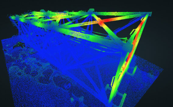
A big challenge that a lot of surveyors face during the photogrammetry process is getting the final georeferenced map products to align properly with their or their clients’ existing geospatial data. This is not because the data is bad, but often because there has been either an incorrect datum transformation, a projection error, or simply because the drone data has not been transformed to match the source data. The elevations can be the hardest to troubleshoot because the map looks fine, but when you hand the point cloud or a surface model to an engineer who compares it to existing data, there is a consistent (or worse, a very inconsistent) vertical shift across the entire dataset. More often than not, this is due to a user error in the data processing parameters, a lack of local geoid model support in the chosen photogrammetry software,
The Alteia platform makes this problem easy to avoid by taking care of it at the very beginning of the process. The most common professional mapping drones record the photo center coordinates in the exif data in WGS84 latitude / longitude for the horizontal, and either ellipsoid or EGM96 height in meters for the vertical. When users import these photos into the Alteia platform, the WGS84 latitude / longitude coordinates are automatically read, then users indicate whether the elevations are in ellipsoid height or according to a certain geoid model (such as EGM96).
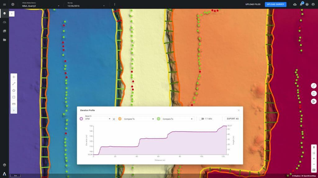
Next, users can select the coordinate reference system (CRS) in which they want to process data and ultimately export any layers. This is where Alteia is adapted to the surveyors needs. They can select their preferred projected CRS from a library by searching for the EPSG code or by keyword.
Then finally, they can set the vertical CRS to either the ellipsoid height of the selected horizontal CRS, or to any one of multiple local geoid models supported and maintained in the Alteia platform. Currently, this includes many Geoids for North America and Europe, and more regions will be added based on customer demand.
For example, if users are doing a topographic survey near Boise, Idaho, USA, they can set the CRS to the state standard of US State Planes NAD83, Idaho West zone, in US survey feet (EPSG code 2243) and set the vertical CRS to use GEOID12B in order to adhere to the NAVD88 datum.
While the Alteia platform is often looked to for the advance business analytics it provides for mines, quarries, construction, agriculture, and other markets, it is important to highlight that the core functions of the platform are designed to support the workflows and high-accuracy data products that land surveyors require.
___
About Alteia
Alteia is the Visual Intelligence Platform for Enterprise. Alteia offers a comprehensive software platform that enables enterprise customers to leverage visual data in order to make better decisions. With Alteia, data scientists, business analysts and operation teams can all work together around a central repository of all their visual data, where they rapidly build predictive models and tailored high-value business applications.
Warning: Trying to access array offset on value of type null in /home/sftpuser/alteia.agencejill.com/wp-content/themes/alteia/single.php on line 151
Share article


Next articles